TONY'S TOUR DE TASMANIA
TONY WATTON
27/10/2015 to 18/11/2015
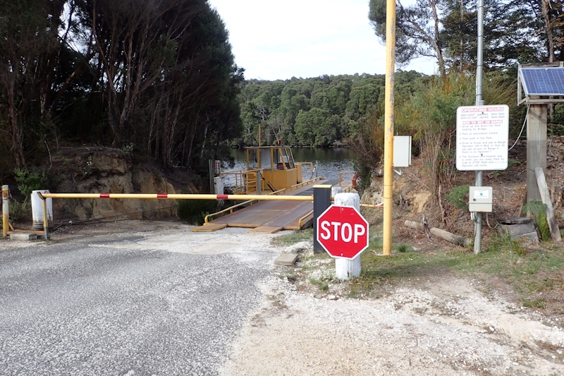
FindMeSpot - Gen 3 - tracking positions sent to nominated emails and phones during the trip.
Preliminary Thoughts
My previous attempt to ride around Tasmania in a clockwise direction, three years ago, did not succeed. I came to the conclusion that several factors contributed to my finishing at Wayatinah: the tough, generally uphill nature of the road to the West Coast, my lack of riding preparation, my overweight physical condition and having too much gear on the bike. This time I had been using my exercise bike every day since the start of the 2015 Tour de France (in early July during ad breaks) and had continued a daily 25-minutes routine of exercise bike until late October. This, combined with some day rides of between 40kms and 60kms, had enabled me to achieve a better level of fitness. I also intended to take less gear and to ride in an anti-clockwise direction, starting with the easier East Coast of Tasmania.
I expected to take around four weeks, including an allowance for possible rest days as I might want or need them.
A few days before I started on 27/10/15 Matthew, my son, said he had managed to get four weeks leave and was intending to use his new Surly touring bike to travel to the West Coast, up the Western Explorer to Marrawah, then via inland roads to meet me, possibly at Low Head at the mouth of the Tamar River and then ride with me back down the West Coast and eventually home.
I was a bit disappointed with his plan, because I would have liked to have his company on my ride, but pleased that he was doing a tough ride as well. [On our bushwalking adventures we often remark that it is good to share the pain of our endeavours, as well as the good experiences.]
Matthew left on his ride on 23/10/15, travelling to Mount Field National Park, Maydena and Wayatinah, before arriving in Queenstown on 27/10/15. This is where his ride finished as he had developed a severe pain in his right knee, probably from wrenching as he disengaged from the new, tight pedals. He caught a bus back to Hobart, had a few days rest and then drove to Tomahawk on 1/11/15, intending to ride with me for the remainder of my trip while leaving his car at Deloraine.
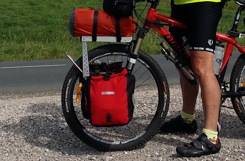
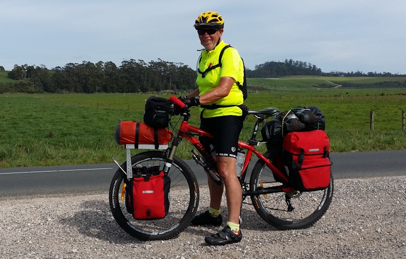
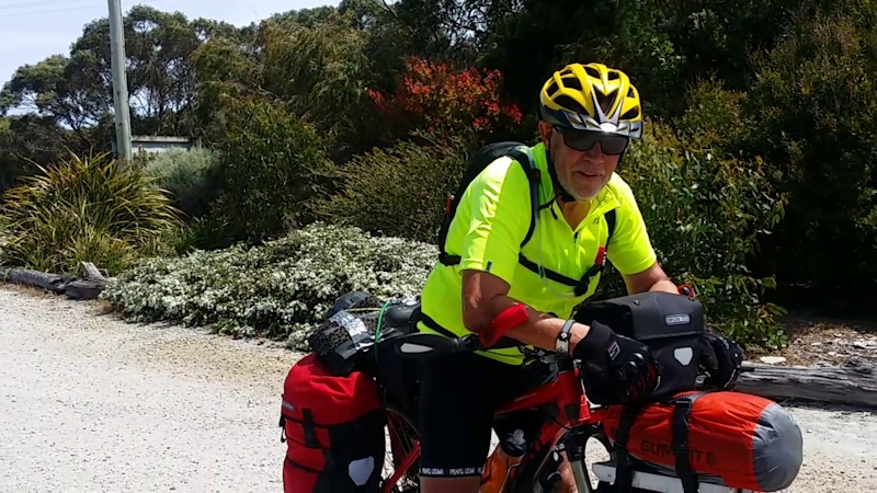
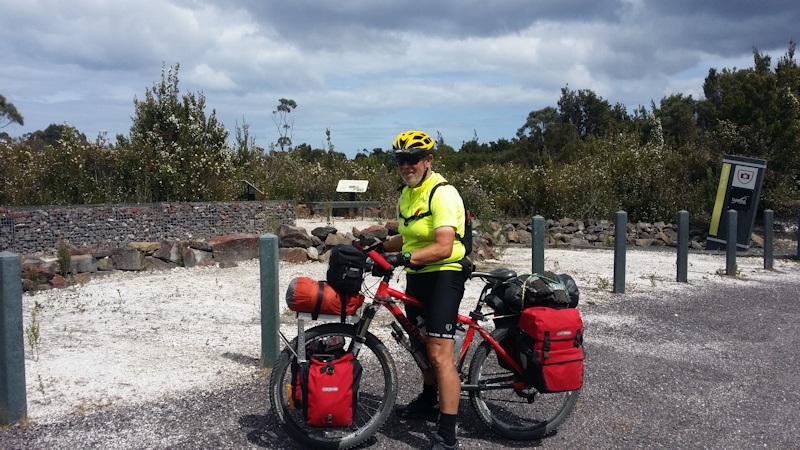
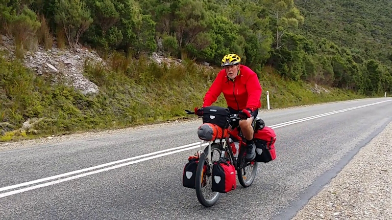
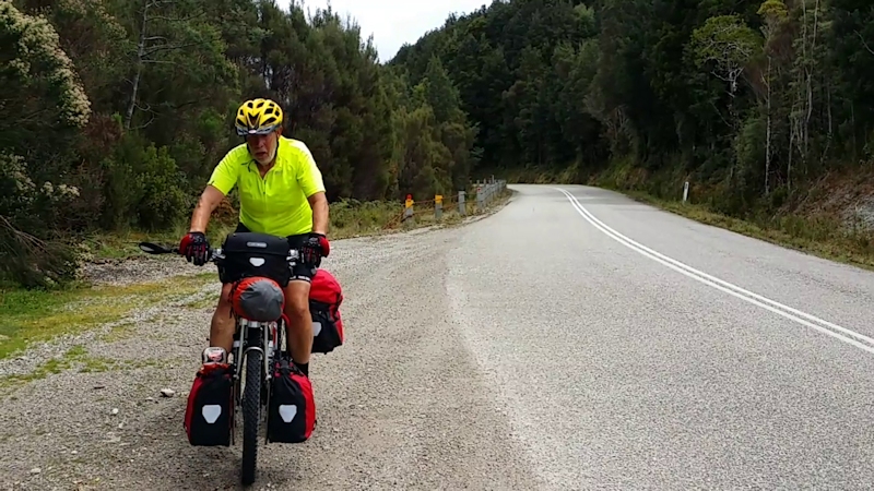
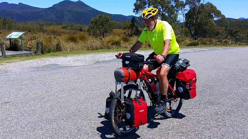
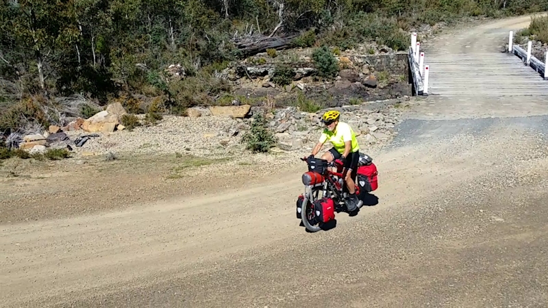
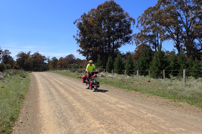
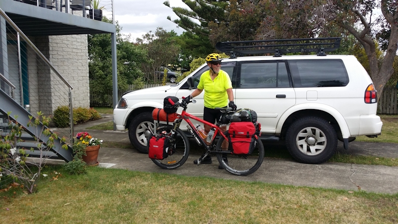
My bike (Giant XTC 2 2003 model) was set up with Tubus stainless steel pannier racks, Ortlieb waterproof panniers and an Ortlieb waterproof handlebar bag, plus a home-made front rack for my sleeping bag. At the back of the bike I had a Fly6 camera/flashing light. My bike computer was a Garmin Edge 800, a wonderful asset but on this trip I had lost access to the map software. I also carried a FindMeSpot - Gen 3 - tracker that sent 10-minute updates of position information to the SPOT server, with "check-in" end of day positions sent to nominated emails and phones. It also had SOS and non-urgent help messages if needed. My phones (Samsung Galaxy Note 2 with iiNet and Samsung Galaxy Core Prime with Telstra), Edge 800 and Fly6 all needed daily charging so I also carried a 5-volt Power Monkey Extreme with a small solar panel for times when no mains power was available.
The front pannier rack platform was fastened to the U-frame of the front forks with a shaped clamp. The Tubus rack was attached to the suspension tubes by stainless steel clamps that I had shaped to fit the correct diameters of the tubes (behind the pannier bags). A longer skewer than the standard one was needed for attaching the lower rack mounts. I drilled through the vertical supports to save weight (maybe 5gms in total!). There were no breakages of gear or punctures on this trip.
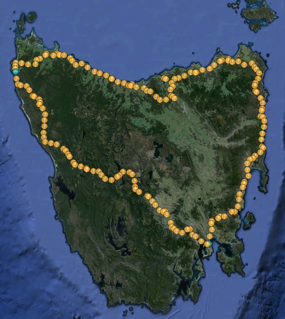
My Ride Stages
| Stage | Date | From | To | Distance (kms) | Total Time | Moving Time | Av Moving Speed (kms/hr) | Max Speed (kms/hr) |
| 1 | 27/10/15 | Lauderdale | Triabunna | 81.3 | 7 h 53 m | 5 h 52 m | 13.8 | 52.9 |
| 2 | 28/10/15 | Triabunna | Swansea | 50.5 | 4 h 38 m | 3 h 33 m | 14.2 | 44.6 |
| 3 | 29/10/15 | Swansea | Bicheno | 43.0 | 4 h 20 m | 3 h 01 m | 14.3 | 51.4 |
| 4 | 30/10/15 | Bicheno | St Helens | 75.4 | 6 h 44 m | 5 h 04 m | 14.9 | 46.1 |
| 5 | 31/10/15 | St Helens | Gladstone | 66.9 | 7 h 36 m | 5 h 12 m | 12.8 | 45.3 |
| 6 | 1/11/15 | Gladstone | Tomahawk | 32.6 | 3 h 19 m | 2 h 26 m | 13.4 | 51.5 |
| 7 | 2/11/15 | Tomahawk | Bridport | 45.8 | 3 h 23 m | 2 h 55 m | 15.7 | 45.2 |
| 8 | 3/11/15 | Bridport | Low Head | 58.0 | 5 h 14 m | 3 h 37 m | 16.1 | 53.8 |
| 9 | 4/11/15 | Low Head | Frankford/Birralee Rds | 64.1 | 6 h 15 m | 4 h 43 m | 13.6 | 53.5 |
| 10 | 5/11/15 | Frankford/Birralee Rds | East Devonport | 52.5 | 4 h 35 m | 3 h 14 m | 16.2 | 53.5 |
| 11 | 6/11/15 | East Devonport | Wynyard | 69.6 | 6 h 30 m | 4 h 26 m | 15.7 | 51.9 |
| 12 | 7/11/15 | Wynyard | Smithton | 67.0 | 6 h 43 m | 4 h 41 m | 14.3 | 53.3 |
| 13 | 8/11/15 | Smithton | Arthur River | 61.5 | 5 h 24 m | 3 h 59 m | 15.4 | 52.2 |
| 14 | 9/11/15 | Arthur River | Lindsay River Bridge | 53.6 | 5 h 33 m | 4 h 02 m | 13.2 | 60.5 |
| 15 | 10/11/15 | Lindsay River Bridge | Savage River Bridge | 50.7 | 8 h 37 m | 5 h 24 m | 9.4 | 51.4 |
| 16 | 11/11/15 | Savage River Bridge | Zeehan | 54.8 | 7 h 38 m | 4 h 45 m | 11.5 | 63.0 |
| 17 | 12/11/15 | Zeehan | Queenstown | 38.7 | 3 h 59 m | 2 h 58 m | 13.0 | 56.3 |
| 18 | 13/11/15 | Queenstown | Collingwood River Bridge | 47.7 | 4 h 59 m | 3 h 36 m | 13.3 | 59.4 |
| - | 14/11/15 | Rest Day in Queenstown | - | - | - | - | - | |
| 19 | 15/11/15 | Collingwood River Bridge | Derwent Bridge | 38.5 | 4 h 47 m | 3 h 14 m | 11.9 | 50.2 |
| 20 | 16/11/15 | Derwent Bridge | Ouse | 74.9 | 6 h 29 m | 4 h 42 m | 15.9 | 66.3 |
| 21 | 17/11/15 | Ouse | New Norfolk | 54.3 | 4 h 46 m | 3 h 23 m | 16.0 | 57.6 |
| 22 | 18/11/15 | New Norfolk | Lauderdale | 54.9 | 4 h 36 m | 3 h 16 m | 16.8 | 53.1 |
| Total | 1,236.3 | |||||||
The average distance travelled each riding day was 56.2kms.
I weighed myself, bike and the individual packs just before I left on the first stage. Weights recorded were:
| Tony | 82.3 kgs |
| Bike | 19.2 kgs |
| Front right pannier | 3.3 kgs |
| Front left pannier | 3.0 kgs |
| Rear right pannier | 8.3 kgs |
| Rear left pannier | 8.5 kgs |
| Tent, poles, pegs, tarp | 4.0 kgs |
| Sleeping bag | 1.7 kgs |
| Handlebar pack | 1.9 kgs |
| Bum bag | 1.1 kgs |
Total weight of gear carried was 31.4kgs.
Stage 1 - Tuesday 27/10/15 - Lauderdale to Triabunna (81.3kms)
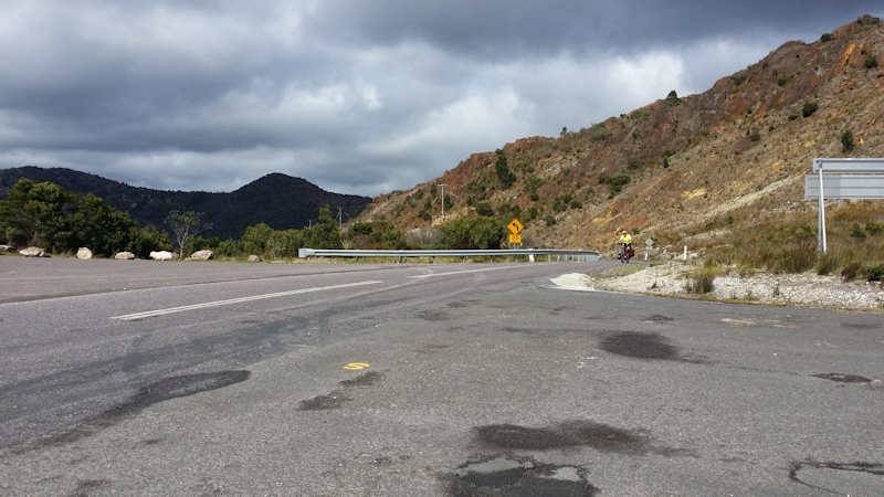
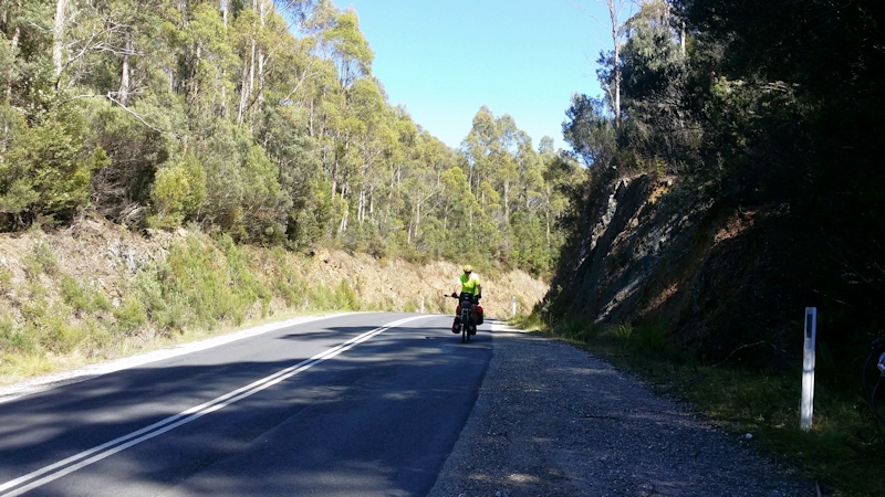
I left at 8.51am in good weather conditions. The bike took a bit of getting used to, with the load, particularly when the front wheel seemed to want to take me to places I didn't want to go to, such as in the gravel or gutter on the left or to the middle of the road. This was worse at very low speeds going uphill.
At Sorell I stopped at a bench seat on the footpath for 10 to 15 minutes then continued on my way. I continuously had in my mind the certain ordeal of travelling up the hills before Buckland, Black Charlies Opening and Bust Me Gall. On my previous ride in 2000 I had to get off and push the bike up both of them and on this trip the same happened. It wasn't too comfortable pushing the bike from the side in shoes that were not flexible, but I eventually made it to the top.
I had previously done a recon by car about what facilities/accommodation there might be at Buckland in case I wanted to stop there. The tavern manager said I could camp behind the tavern, where there was a large grassy area, with clean toilets nearby. However, when I reached Buckland I thought it was too early to stop, at 2.15pm. After buying a soft drink, I continued on my way.
I also needed to push my bike up a hill closer to Orford. When I reached the café near the bridge I bought a coffee then, knowing that the Raspins Beach Camping Ground had been closed, I kept riding to Triabunna.
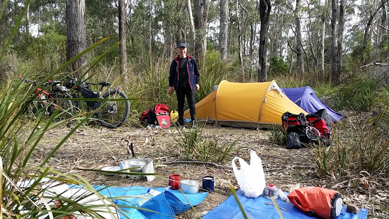
At the caravan park I paid for a tent site and, after setting up the tent and having a shower, walked along to the Fish and Chip Van near the wharf area. For $10 I had a wonderful flathead and chips meal while enjoying the late afternoon sunshine, and met a touring bike rider from Israel, before heading back to my tent. During the evening I made a cup of tea in the camp kitchen area as I chatted with a caravan tourist from NT.
The night was cold and I felt a bit uncomfortable with my 2-seasons sleeping bag. It wasn't quite cold enough to encourage me to find my thermal sleeping bag liner. I eventually slept while my bike GPS and Fly6 camera/light recharged from my Power Monkey.
Stage 2 - Wednesday 28/10/15 - Triabunna to Swansea (50.5kms)
When I woke at 6.00am I was annoyed to discover a pool of water under my sleeping mat and my camera case wet. It seemed that, because I had put the backpack drinking bladder in the tent, lying down, it had leaked overnight. I didn't make that mistake again.
I eventually got most things dry in the early sun while enjoying my breakfast of a cup of tea and a muesli bar.
Packing up took longer than it should have because of chats I was having with other tourists, but eventually I was under way by about 10.00am.
I needed frequent rest breaks on the way to Swansea and was quite surprised at how undulating the road was, although I didn't need to get off the bike to push it. I eventually reached Swansea at 2.15pm, just about all in and stopped at the first coffee shop I saw to replenish the tank. During the ride I had eaten only two small bite-sized Mars bars with water and Gatorade to keep me going.
When I got back on my bike to ride along to the backpackers accommodation I must have been delirious because I clipped into the pedals too early, with no road speed, and immediately fell off the bike into the gutter. After cursing myself I started off again, using the platform sides of the pedals, as I should have done before. No major damage, physically at least.
At the backpackers I have a room, untimed shower, laundry, well equipped kitchen, lounge with TV and sofas - all for $31 for the night. Dinner at the tavern next door, followed by a relaxing hour or so talking with two visitors from Brisbane.
Stage 3 - Thursday 29/10/15 - Swansea to Bicheno (43.0kms)
After a very pleasant stay at Swansea Backpackers I took my time preparing to depart, as this day's ride was 43kms and I expected to take only about three hours to complete.
Breakfast was a cup of tea with a shortbread monkey-face biscuit. I left at about 10.15am in perfect riding conditions - no wind and a slightly overcast sky.
All went well until I reached Cherry Tree Hill - an absolute mongrel of a winding ascent. I just gritted my teeth and ground it out. However, the terrific descent on the northern side almost made up for the suffering in getting up the southern side of the hill.
On the way up a bike rider passed me in the opposite direction. He had a one-wheeled trailer (probably a BOB trailer). He waved and I shouted out "Can't stop" as I waved back.
The problem I have when ascending steep hills is that, if I get off for a rest, because I would be in the granny gear, starting off again is very difficult because half a revolution of a pedal does not equate to a meaningful rotation of the wheels. Consequently, there is not enough road speed to get me going again. This is one of the reasons (apart from physical inability) I chose to push my bike up very steep hills instead of struggling to ride up them. [Later in the trip I adopted the practice of changing gear at the handlebar and manually turning the pedal to engage a more useable gear to help me to start off again.]
At about 12kms south of Bicheno, near the Coles Bay Road junction, I couldn't resist having a toasted sandwich and a cup of coffee in very pleasant surroundings.
Even though I took all camping gear with me I booked in to the Bicheno Backpackers accommodation for the night. Budget eating - a tin of Irish stew with a buttered roll and biscuits and cheese to follow.
At that time I was the only occupant of the building but during the evening three more people arrived to stay in adjoining rooms.
Stage 4 - Friday 30/10/15 - Bicheno to St Helens (75.4kms)
After a very peaceful night my watch alarm woke me at 5.00am so that I could ensure a reasonably early start to the day's riding.
Breakfast was a bread roll with butter and the smallest jar of strawberry jam imaginable, plus Gatorade from the previous day's ride.
After carefully packing my gear in an attempt to even the weight between left and right (only clothes in the front pannier bags) I started out at 7.45am in very pleasant riding conditions, overcast and calm. But all good things come to an end (as the cliché goes) and within an hour I was riding into a head wind. This, combined with undulating roads, made for a difficult day of riding.
In order to split the distance into manageable chunks I had decided to ride 10kms then have a brief rest stop, with a snack at 20, 40 and 60kms. I also decided to use my dual-purpose pedals better so that I was prepared when ascending steep hills to step off the bike at short notice. To do this, as I approached a hill I unclipped my bike shoes and turned the pedals over so that I was pedalling on the flats of the pedals. It sounds obvious but needed a conscious effort while I was riding.
I was very relieved to reach Scamander at about 2.15pm and rewarded myself with a coffee and toasted sandwich. While I was at the takeaway shop several police cars, an ambulance and an SES truck headed south at considerable speed, with lights and sirens, presumably to attend an accident/crash further south. [I later learned that a motor cyclist had suffered a broken leg on the St Marys road, away from the coast. Fortunately not life-threatening.]
From Scamander to St Helens, a distance of 16kms, I decided to ride 4kms then have a brief rest and repeat as I was feeling very tired near the end of a big day of riding.
At St Helens I booked a tent site at the Big 4 Holiday Park, set up the tent, showered and changed clothes and walked into town for a snack. I spent a very comfortable evening, enjoying the well-appointed camp kitchen and TV lounge.
Stage 5 - Saturday 31/10/15 - St Helens to Gladstone (66.9kms)
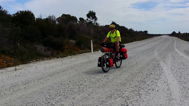
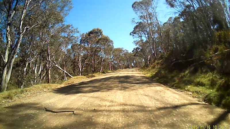
Another early wake-up call from my watch alarm at 5.00am for what promised to be a very demanding day for bike riding. The penalty for avoiding the climb of Weldborough Pass was that, for most of the way to Gladstone, there was a gravel road. Even with 2.2" wide tyres there was no time when I was not concentrating 100% on just where I was on the road. For most of the time I chose to stay in the lowest range of gears and used the flats of the pedals so that I could step off quickly should the need arise - which it did whenever I struck a patch of softer gravel at the left of the road.
Another reason for staying in the granny range was that the shifting mechanism between the middle and low range chainwheels sometimes didn't work and I needed to avoid starting up a hill in the wrong gear range. RP7 would have fixed this immediately but instead I just persevered.
On this section of the ride I met two youngish men riding MTBs, out for a day ride from Ansons Bay to St Helens for a cup of coffee, from where they were to be collected and taken back to their shack. Not a bad life, I thought. They told me that the descent to Ansons River, and the ascent away from it, had had the road surface sealed - presumably making it safer to negotiate. [I recalled my horror descent of that particular stretch of unsealed road on my ride in the area in 2000.] I still needed to push my bike up the other side of the valley.
The remainder of the ride up to the T-junction where Ansons Bay Road met Gladstone Road was unpleasant as I encountered head winds but no rain, although it had been forecast.
As soon as I turned left I felt the benefit of a tail wind that lasted almost the whole of the last 30kms of this day's trip. At about 2kms from Gladstone, where the road crossed a bridge over the Ringarooma River, there was a particularly nasty hill; I was determined not to let it beat me so close to my destination for the day and gutsed (is that a word?) it out without getting off or stopping.
At the Gladstone Hotel I stumbled into the Public Bar, where there were maybe a dozen people standing around drinking. I must have looked all in because somebody asked me, "Why do you do it?" My immediate answer was, "Well, the thing is - I've got this wife at home ..." at which the room erupted in laughter. I didn't need to say anything else.
I stayed at the Gladstone Hotel with a single room and had dinner at the pub. It was all very plain - probably dating back to the 1940s - but comfortable enough for an exhausted bike rider. During the evening I chatted with an elderly Tasmanian couple (Stewart and Sue) who regularly stayed at country pubs around the State - nostalgic I suppose.
Stage 6 - Sunday 1/11/15 - Gladstone to Tomahawk (32.6kms)
I left Gladstone at 9.30am and was faced immediately with a challenging climb. At least it was on a sealed road which, unfortunately, didn't last long before turning to gravel. Whenever it was possible I moved over to near the centre of the road to allow me to take advantage of slightly smoother and cleaner conditions. I frequently used my mirror to check behind me, as well as constantly being wary of vehicle road noise.
This was only a relatively short leg of my trip but, with most of it on gravel, it was far from an easy half day. There was one particularly long straight stretch of road that appeared to rise so steeply that it seemed to reach the sky! On this section there were several false flats on the ascent. I had frequent rest stops and ate two of the three sandwiches that I had prepared at breakfast at the Gladstone pub earlier in the day.
As noted earlier in this account, Matthew had driven from Midway Point and met me 2kms from the turn-off to Tomahawk. It was good to see him.
While I was at St Helens I had discovered that it was a long weekend in the north of the State (Recreation Day!) so I had phoned ahead to book a tent site at the Tomahawk Caravan Park. Matthew said he would go on to Tomahawk and try to change the booking to a cabin, if there was one available. Well, a cabin was available and we spent a very comfortable evening and night at Tomahawk. Matthew surprised me by producing two bottles of Mexican beer that had been left for me by Stewart and Sue, who I had met at Gladstone the previous day. Thank you to you both for that kind gesture.
Stage 7 - Monday 2/11/15 - Tomahawk to Bridport (45.8kms)
My watch alarm woke me at 5.30am but I had already woken at 2.00am, made a cup of tea and then gone back to bed for a bit more sleep. I left at 8.26am in very pleasant riding conditions, calm and overcast to sunny. However, after less than an hour the breeze commenced, coming from my right, about 45o. It was a very straight, undulating road with many vehicles passing me from behind. I imagined they were people returning from their long weekend away at the North-East Coast.
Meanwhile, Matthew had driven on to Bridport to check out possible accommodation options and then rode his unencumbered bike back to meet me, about 12kms from Bridport. He wanted to test out his injured knee without the additional weight of a heap of gear attached to the bike.
Riding this last section was most unpleasant and I needed several rest stops as I battled strong headwinds all the way to Bridport. We arrived at 11.50am. Matthew had booked us into the backpackers accommodation and he paid for our stay. Thank you once again Matthew. We had a very comfortable room and a spacious lounge with all facilities. After showering and changing we wandered along to the shops to enjoy a salad roll/curry pie before heading back to our lodgings to relax for the remainder of the day.
My neighbour, Keith, visited us during the afternoon, having driven from Lauderdale on his first trip to Bridport. He brought a birthday card for me on 3/11/15 and some energy bars to help me while riding. Thank you Keith - much appreciated.
Stage 8 - Tuesday 3/11/15 - Bridport to Low Head (58.0kms)
We checked the forecast for this day's ride and were pleasantly surprised to find that easterly winds were expected for this stage of the trip. I was ready to leave by 9.00am. As soon as I joined the road to Georgetown I felt the benefit of a reasonable tail wind that lasted all the way to the Georgetown turn-off at the East Tamar Highway.
Matthew's plan for the day was to drive to Low Head to check at the Low Head Holiday Park whether they had accommodation available, then load up his bike to ride back to where he would meet me and join me riding back to Low Head.
When I reached the Pipers River take away shop, 33kms from Bridport, I stopped for a cup of coffee and a toasted sandwich and waited for Matthew to arrive. As I waited, a man from a nearby car said he had passed a male and a female heading in my direction and thought I might be waiting for them. I said the male was probably my son but I had no idea about the female.
Anyway, after waiting for a further half an hour I decided I needed to leave, hoping Matthew would be OK, and not delayed for any bad reasons (health or breakdown for instance).
Before I left I checked my phone for his FindMeSpot position but he had left it turned off. Within 5 minutes I met Matthew and we travelled together to Low Head. On the way we met the female cyclist. She was 'Deb' from Queensland, on a hired bike, and had called in to Georgetown for supplies after leaving Low Head. I booked us into a very comfortable, new looking cabin. Later Matthew bought us a Chinese meal to celebrate my 71st birthday.
On this leg of the trip I started to experience sharp, shooting back twinges while not on my bike as I twisted or stretched. They lasted only one or two seconds but made me jolt (and lose strength with a mini-back-collapse) with the sudden pain. Not sure what to make of this unexpected and new problem.
Stage 9 - Wednesday 4/11/15 - Low Head to Frankford/Birralee Roads (64.1kms)
This was a day when I really questioned if I knew what I was doing on this ride!
While I left Low Head at 8.20am to travel to Frankford Road, Matthew drove to Deloraine, where he left his car near the Police Station, packed his gear into pannier bags and rode along Birralee Road. He travelled via Westbury with the intention of meeting me when I arrived at the junction of Frankford Road and Birralee Road, hoping to find an acceptable bush camping site.
My ride soon became one of trying to ride very close to the left hand side of the highway to give vehicles enough room to pass, while trying to avoid loose gravel or gullies. The strong cross wind did not help me. However, most vehicles did move over to give me some room. Even so, it was a relief to turn off the highway to head for the Batman Bridge.
After I had crossed the bridge my route would take me to Exeter, where I intended to check Matthew's progress on his tracker. I decided not to use the West Tamar Highway and instead took the scenic, hilly route alongside the Tamar River through Deviot and Gravelly Beach. By taking this route (a change to our discussed plan) my approach to Exeter would be from the other direction but I did not realise this at the time.
I was looking forward to a snack at Deviot, but no shops, so at Gravelly Beach took the opportunity to get a cup of coffee and a sandwich on the main road. When I joined the West Tamar Highway there was no sign indicating to Exeter and I turned left instead of right. I was therefore heading in the wrong direction. As I was climbing the humungous Bradys Hill Matthew repeatedly tried to make phone contact on both my phones. As I was intent on climbing the hill without stopping I did not want to stop to answer the calls. I should have.
At the top of Bradys Lookout I called Matthew and he frustratedly gave me the news and asked me if I really knew that I was heading into Launceston instead of to Exeter.
I was then faced with the problem of going back the other way on a four-lane highway that was divided by steel cables as far as the eye could see. No break in the cables so I was forced to struggle to lift the bike with all its gear over the wires before eventually heading to Exeter. I felt ridiculously stupid. After a very fast downhill run I reached Exeter having ridden 12kms more than I needed to. I turned off at Exeter along the Frankford Road. The ride was uneventful except that I needed to push the bike up part of a steep hill near the Birralee Road junction after having fallen while getting off my bike.
Matthew, meanwhile, had found a quiet bush camp site, off the main road up a gated Forestry track, where we spent a peaceful night after enjoying salad rolls, courtesy of Matthew, and a cup of tea. My back continued to give me problems with sharp twinges that lasted only a couple of seconds but that Matthew said looked as if I had been shot in the back. It was OK while riding so I just put up with it while I was off my bike.
Stage 10 - Thursday 5/11/15 - Frankford/Birralee Roads to East Devonport (52.5kms)
As far as bush camps are concerned, this was about as good as it gets. The ground was flat, off the main road in a Forestry area. The night was calm, just a few spots of rain that had cleared up by the time we were out of our tents just after 6.00am. We were able to pack our gear away by having it laid out on tarps outside the tents, which made packing up very easy.
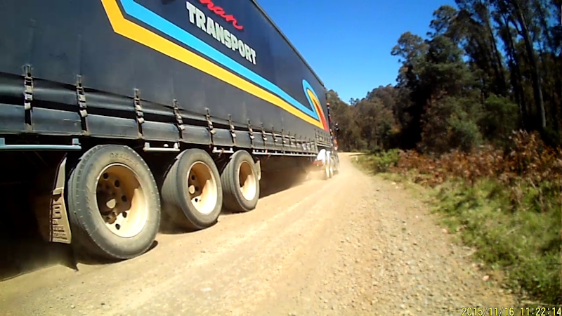
Just after leaving the camp site, at 8.00am, we were faced with the first of many hill climbs, some moderate, but some cruel. There was also a constant presence of trucks heading to and from Devonport, using this road as a short-cut from Bell Bay. We thought maybe the truck drivers were kind enough to alert other truckies of our slow pace via their CB radios. We gave them a wave as they passed.
At Frankford there is a café. In view of the fact that we had only eaten two small Mars bars we were (I was at least) looking forward to having a breakfast snack. Not so. The place was closed and did not look as if it was going to open any time soon. We pressed on up some steep climbs and some enjoyable descents.
With about 15kms to go to East Devonport Matthew felt his knee injury flare up again. It was so painful for him that on a couple of hills he was forced to push his bike up them. He decided that, in order to prevent more damage occurring, he would finish his bike tour at East Devonport. He checked on bus times from the Spirit of Tasmania terminal to Deloraine and booked a ride for Friday morning. He said it would give him the opportunity to do some exploring on the North-West Coast by car and meet up with me on my trip from time to time. I was sorry he would not be riding with me for the remainder of my bike trip but obviously his health came first. I suggested he might head home and get his knee seen to immediately, rather than delay any possible treatment.
We eventually made it to the Abel Tasman Caravan Park at East Devonport where we hired a comfortable cabin for the night. During the afternoon we did some washing in the laundry while watching a mother plover with her two chicks that frequently hid under her wings to avoid perceived danger while she sheltered the chicks from the heavy rain. I'm not a fan of plovers but this was quite a touching scene of a protective mother looking after her young.
Stage 11 - Friday 6/11/15 - East Devonport to Wynyard (69.6kms)
Matthew left at 7.10am, carrying a light back pack, to catch the bus back to Deloraine so that he could collect his car. All his gear was left in the cabin for him to collect on his return maybe two hours later.
Meanwhile, I packed up my stuff and I was back on the road by 8.30am, having hidden the key in the "secret" hiding place under a stone to await Matthew's return.
Weather conditions had improved dramatically from the previous afternoon and evening - rain and overcast - to calm and sunny, with no rain.
Traffic conditions were a different matter, though, with B-double trucks, amongst others, barrelling along less than a couple of metres away from me at around 110kms/hr. On a couple of occasions when a truck passed I had the feeling that my bike and I were being sucked in towards the rear side of the truck. Quite frightening.
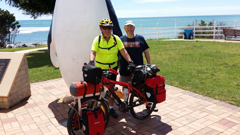
At Ulverstone I took the quieter and more scenic coast road to Penguin after having a cup of coffee at a shop in Queen Street. This route was delightful with scenic views and quite quiet. I met up with Matthew in Penguin, where I had a salad roll. Matthew took a photo of me with the giant penguin and a stranger took one of both of us with half of the penguin.
Riding through Burnie was a bit of a worry, with traffic lights, wind, heavy traffic, hills and my loaded bike all conspiring to make a very challenging ride. After Burnie it was a clear, easy run taking the quieter foreshore road to our cabin accommodation at Wynyard. We enjoyed a fish and chips meal at the shop on the wharf - no resident seal near the wharf any more - then a relaxing evening. I was still getting back twinges but tried to ignore them. Maybe they would go away.
Stage 12 - Saturday 7/11/15 - Wynyard to Smithton (67.0kms)
I left Wynyard at 8.40am. Wind, wind, wind, wind, wind. Almost as soon as I rejoined the Bass Highway the hills began and the confounded wind added another element to make life difficult.
It was a relief to reach the Boat Harbour shop where a cup of coffee went down really well. Matthew met up with me at several spots along the way and provided some much needed moral support as well as buying a cold drink and a salad roll for me. [At various times on this trip people asked me why I was still carrying all my gear when there was a car available to make life easier. My reply was that I had started out with everything I would need and that was the way I wanted to continue. Just my obtuse, obstinate mind at work I suppose.]
During the previous evening Matthew suggested, by checking with Google Maps, that a short cut from Wiltshire through Forest would cut a couple of kilometres from the ride to Smithton. It seemed that, although there might be a couple of hills, as opposed to dead flat on the Bass Highway, this might be a good alternative. At the start of the short-cut through Forest I ate the salad roll. Just as well, as I certainly needed some sustenance to tackle the multiple steep sections of this straight back road. I was determined to ride all the way to their tops, even though it was a big effort. In these situations I timed my breathing to match my pedal cadence, huffing and puffing in time. It seemed to help but to an onlooker would appear very weird.
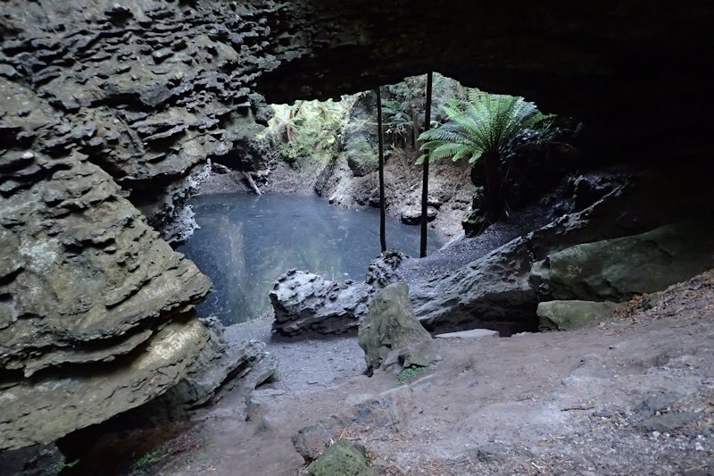
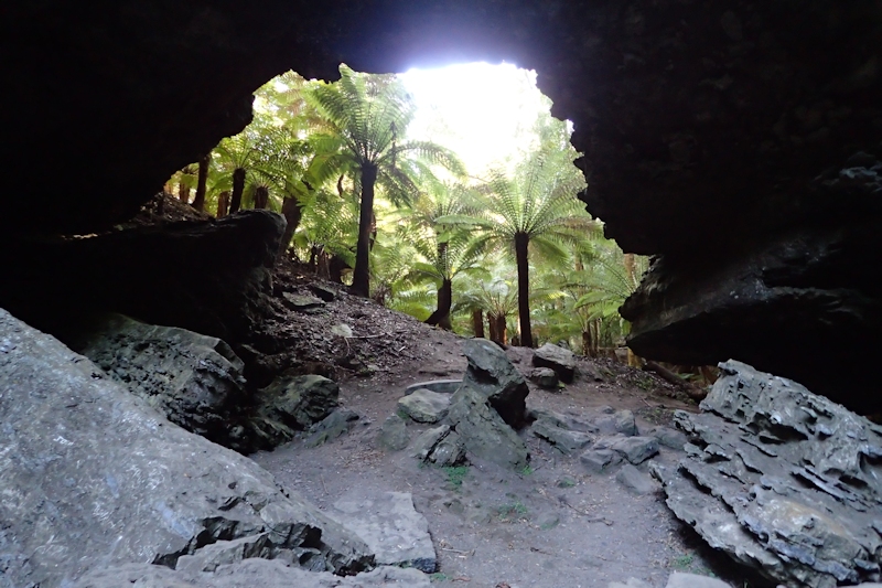
When riding between towns I really looked forward to seeing first of all the 80kms/hr sign and then the 60kms/hr sign in the town itself. I reached Smithton at 3.15pm and we booked ourselves into the Bridge Hotel. A plain, twin-bed room with shared showers and toilets but comfortable enough. After showering and changing Matthew suggested a car ride to see Trowutta Arch, an area of sinkholes filled with water and a rocky 'bridge' of land over them. I had never heard about this so was quite intrigued and agreed. I was surprised there were no road signs indicating we were even close to it but the visit was well worth the ride and 15 minutes walk through delightful forest that looked like a ferny glade. Thank you Matthew for the interesting diversion.
Another fish meal at the busy pub (being Saturday evening), flathead with chips and salad with a couple of beers to wash it all down.
The plan for Sunday was to aim for Arthur River Camping Ground rather than Marrawah, where we had both stayed at Green Point Beach on previous occasions.
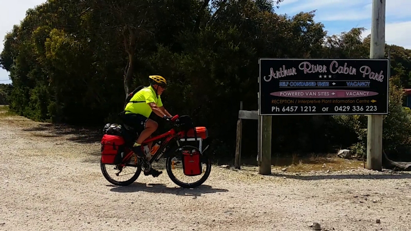
Stage 13 - Sunday 8/11/15 - Smithton to Arthur River (61.5kms)
This was a very good day for riding, especially the first 10kms or so, with a light breeze, level road and very little traffic, being Sunday morning.
After 22kms Matthew was waiting to give me some encouragement. At 40kms I enjoyed a banana roll that Matthew had prepared. Very welcome break. Hills were becoming more frequent, some quite steep, requiring a determined effort and a rest stop at the tops of them.
Just past Togari I saw a large bottle jack lying in the gravel to my left. I guessed it would have weighed at least 20kgs and would have been worth about $100. I left it there even though I normally love to pick up tools from the road. This was a bit too heavy.
At the Redpa turn-off I had a small Mars bar and Matthew headed right towards Redpa, to get a drink from the Redpa shop. Imagine my surprise when I passed the Redpa shop on the highway (not actually at the Redpa township as might be expected). Matthew didn't see a shop on his route.
More steep hills needed to be negotiated, especially the last one right at the end of the Bass Highway, just before Marrawah. To compensate, Matthew once again came to my rescue with a cold iced coffee drink, before I tackled the undulations of the Arthur River Road and the evil last hill leading to our comfy converted shipping container accommodation at Arthur River Cabins.
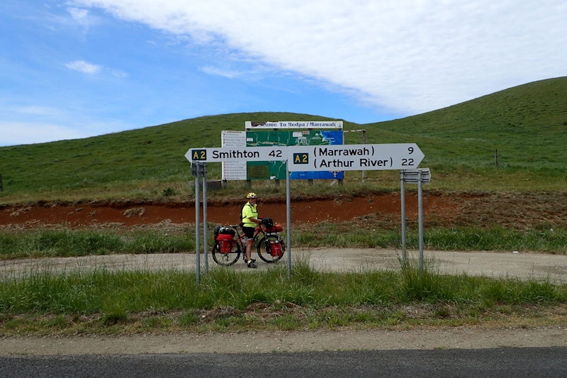
On this stretch of road from Marrawah I was surprised that the road was sealed. From my memory 10 years ago the road was gravel from Marrawah. Certainly an improvement.
We had tinned butter chicken chunky soup with a bread roll for our evening meal and relaxed watching TV later.
Stage 14 - Monday 9/11/15 - Arthur River to Lindsay River Bridge (53.6kms)
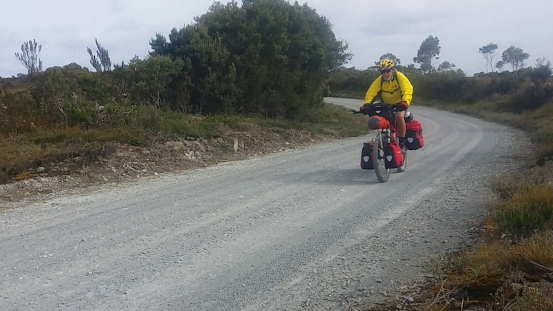
I left Arthur River Cabins at 8.20am in perfect weather and road conditions. There was very little traffic, only two 4WDs near the village then nothing. The road undulated, as I expected it would, and was sealed (as I didn't expect it would be) until the Western Explorer really started at the junction of the road back to Edith Creek.
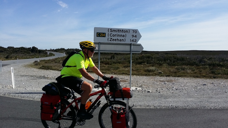
The 15kms of due east riding from the Couta Rocks junction to the Western Explorer was a bit of a battle with a strong side wind on my left side. At this junction the sealed surface was replaced by loose, rocky gravel. However, the wind remained at my back, providing me with a significant benefit as I coped with corrugations, loose gravel and rocks. Before tackling the gravel Matthew had kindly reduced the tyre pressures of my Continental X-King Protection tyres to about 25psi (down from 45psi) to assist in coping with the gravel.
I had frequent stops, with Matthew making me a banana roll at about the 40kms mark. On downhill runs I was very careful not to allow the bike to travel too quickly as I needed to maintain control on the rough road, especially when approaching bends.
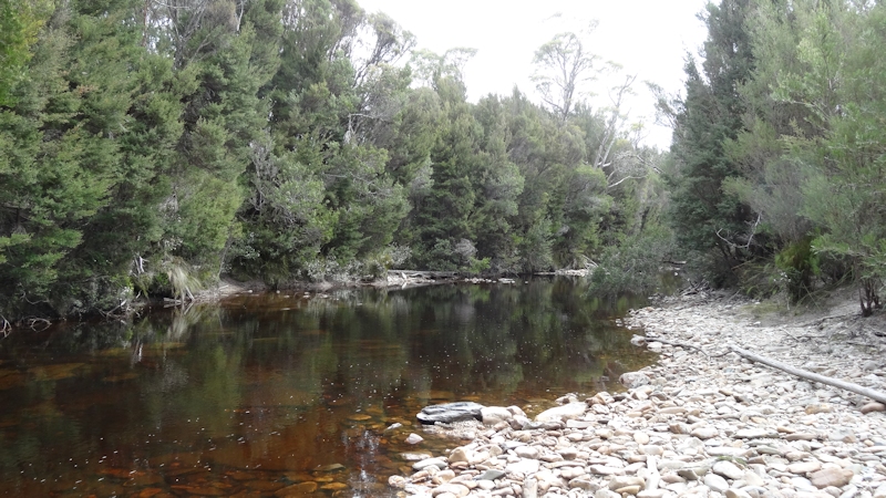
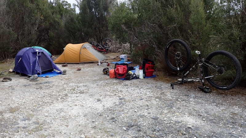
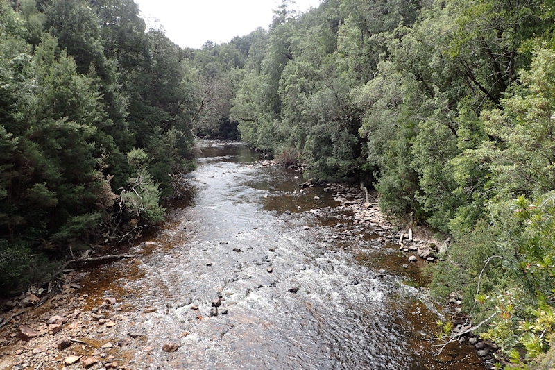
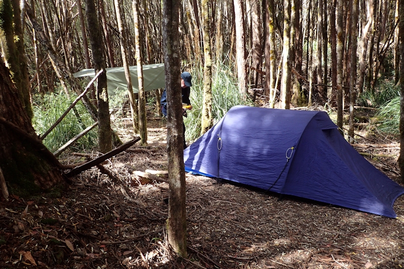
After a particularly pleasant downhill run on a good gravel surface I arrived at Lindsay River Bridge that we had previously checked out online before we left Arthur River. We set up our tents just a few metres from the delightful river in a hard-packed carpark, using rocks to hold our tent guy ropes because the ground was too hard for pegs and enjoyed a cup of tea with cheese and biscuits for a snack. Another tasty tinned meat meal for dinner.
We had a walk across the Lindsay River bridge to the south to look at the next steep hill and use some different muscles. We spotted a camouflaged Tasmanian Devil camera that was attached to a tree on the side of the road. We assumed it was to snap photos of any movement in an effort to establish if the devils were healthy there and how many there might be.
Stage 15 - Tuesday 10/11/15 - Lindsay River Bridge to Savage River Bridge (50.7kms)
This day's ride was always going to be very tough. It was the only day out of the three on the Western Explorer when I started and finished on the gravel surface. I lost count of the number of times I needed to get off the bike and push it to the top of a hill. Matthew continued his good Samaritan work this day, by providing encouragement, snacks and a banana roll on the way. I did not think the road had been improved in the 13 years since I last rode along it. There was a lot of loose rock and large stones, fist sized and bigger, strewn about, as well as the inevitable corrugations on uphill stretches of the road to contend with.
The steep climbs and descents just went on and on. The steepest sections were sealed because if they were left unsealed they would have been torn apart by vehicles trying to climb them, with wheels slipping. The approach to some of these bitumen climbs looked like a vertical wall, blocking the path ahead - especially the one at the southern end of the Longback Range, where the landslip occurred and which shut the road for over a year.

On downhill runs I deliberately slowed down, meaning that I was unable to take advantage of what should have been fast runs. I arrived at the Savage River Bridge at 5.15pm, having started the day at about 8.45am, with the sun still shining on a very pleasant camping spot close to the river.
In my exhausted state, Matthew told me to get into warm clothes before I cooled down too much while he unpacked the bike and set up my tent for me. What a son!
We had a cup of tea and a snack, followed later by another tinned meat meal.
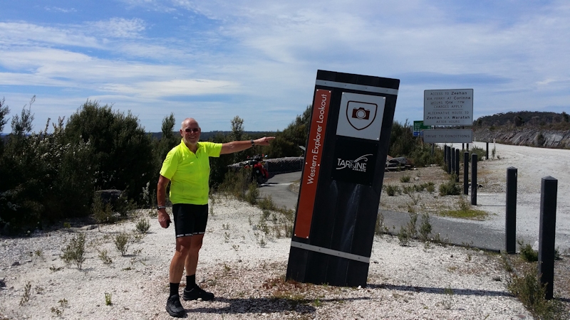
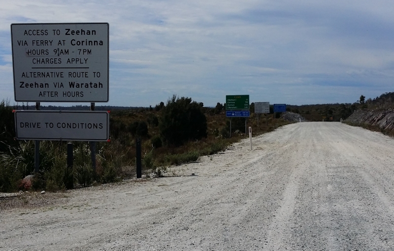
Stage 16 - Wednesday 11/11/15 - Savage River Bridge to Zeehan (54.8kms)
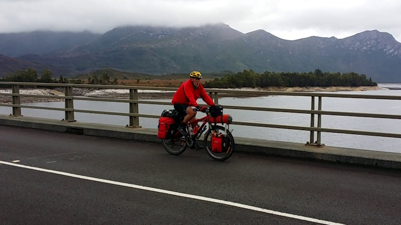
This part of the ride included a crossing of the Pieman River via the Fatman Barge at Corinna. The first 6kms involved me walking the bike about 2kms uphill from Savage River before I was able to actually ride. Even when walking the bike I needed to have frequent rest stops with a brake firmly applied. After 3kms I joined the road down to Corinna from Waratah and the condition of the road improved markedly so that it really was a pleasure to ride on it. This stretch of road brought me to Corinna, where Matthew was waiting to load my gear and bike onto his car (just for the ferry crossing) in order to avoid the extra cost for an unaccompanied bike rider.
We missed the first crossing, which was taken up by an organised expedition mini-bus and its trailer, and were the only vehicle on the next crossing.
According to the notes of my bike trip 13 years ago, immediately after the crossing I had to push the bike up the hill. This time was no exception so, after reloading my bike with all its gear I set off pushing up the hill about 2kms until I reached level ground. This routine of pushing the bike up the steep sections continued for the rest of the gravel road, in total 12kms from the ferry. Meanwhile, Matthew had driven on to Zeehan and bought salad rolls, cold drinks, hedgehog slice and carrot cake and met me to celebrate the end of the Western Explorer.
This left 36kms to Zeehan, all on a sealed road. It was a real pleasure to ride at sensible speeds once again, but I was still faced with quite severe hills to climb before finally rolling into Zeehan at 3.45pm.
We booked into a comfy cabin at the Treasure Island Caravan Park and enjoyed a burger and chips takeaway meal for dinner.
I carried out a bit of gear change maintenance (cleaning and oil) with Matthew increasing tyre pressures back to 45psi with his large bike pump, meaning I would not need to use my small one.
Stage 17 - Thursday 12/11/15 - Zeehan to Queenstown (38.7kms)
Not a desperately early start (9.00am) due to a shorter ride to Queenstown with a level road from Zeehan in calm, overcast conditions. The fun began after the descents to both the Henty and Yolande Rivers, when I was faced with long climbs to higher, level ground. There was no alternative but to walk and push the bike up a narrow highway with traffic screaming past at up to 100kms/hr.
Once again, Matthew provided encouragement and a very welcome iced coffee drink about 20kms along the road. It was a very welcome but controlled run down into Queenstown as the wet road, resulting from recent rain, caused me to limit my downhill speed to a very modest rate to avoid possible cornering problems.
Matthew booked us into the Empire Hotel in a budget room. All necessary facilities were nearby, including a very comfortable TV room and lounge with tea and coffee provided. I think we were the only guests in the hotel that night. We bought salads for dinner, making a pleasant change from our normal evening meals.
Stage 18 - Friday 13/11/15 - Queenstown to Collingwood River Bridge (47.7kms)
We enjoyed a very pleasant stay at the Empire Hotel and discovered that we were indeed the only guests. A Continental breakfast was included so we made the most of the opportunity before packing and leaving Queenstown by 8.42am.
Almost immediately on leaving Queenstown I commenced the climb up Gormanston Hill. It started out OK then about one third of the way up I had a rest at a very wide right hand bend. A bit further up the hill I found I needed to get off and push the bike for about 100m. I then got back on the bike but had to get off again for another 50m near the information shelter.
Matthew was waiting there to encourage me before I rode the remaining few hundred metres to the top. I enjoyed the fast run down through Gormanston and Linda but the rush was over too soon. I knew that before long I would need to think about my next challenge, the climb up to Victoria Pass. Before starting up Matthew made me a banana roll, just when I needed it. Soon after I started the climb I needed a rest break then plodded in granny gear on up to the saddle at no more than about 5 to 6kms/hr. It seemed to take forever.
I recovered my composure at the top then enjoyed the mainly downhill run to our planned bush camp near the Collingwood River, a favourite starting point for rafters venturing down the Franklin River.
Matthew had previously visited this area and knew about a peaceful, level camping area very close to the river along a short foot track. It was a very pleasant place to stay.
We had tinned meals for dinner, with a bread roll, cup of tea and cheese and biscuits later while listening to Day 1 of the 2nd Test Australia/NZ in Perth. Warner was 244 and Khawaja out for 121. Australia 2 for 416. Awesome. [Not so awesome as things eventually turned out with NZ overtaking Australia's 1st innings score, leading to a drawn match.]
Saturday 14/11/15 - Day in Queenstown
Well, this was not how the plan was supposed to happen! I had to head back to Queenstown - and this account is a bit gross, so probably is out of place in a travel report. But this is what happened.
Because I have a permanent suprapubic catheter (SPC) that solves a problem of a urethral stricture following radiation therapy for prostate cancer 11 years ago I need to use a urine drainage bag at night in order to avoid getting up every 30 minutes or so to empty my bladder. My small bladder is also a side effect of the radiation therapy.
At about 4.00am in my tent I felt very strongly the need to empty my bladder. I thought the tube leading to the bag might have a kink but in fact the catheter from my body was actually blocked with deposits existing in my urine. I was left with a dilemma. In the past if this situation occurred I would drive to a Hospital Accident and Emergency Department to have the catheter replaced and so relieve the problem. This was not an option in this remote location.
In my gear I carried a spare catheter but the old catheter was secured inside my bladder by a small balloon that was inflated with sterile water from a syringe that would be temporarily attached to the end of the catheter.
I did not have either a syringe or sterile water with me, but I needed to act quickly as my bladder was continuing to fill and the feeling of discomfort was increasing.
It was raining at the time but as Matthew had had the foresight to put up his 3m x 3m overhead tarp the previous evening there was at least somewhere dry for me to address my problem.
In my tent I gathered together the new catheter, my head torch, scissors, tape and alcohol wipes and mentally prepared myself to replace the catheter. Normally, in a clinical situation, a nurse would use a second syringe to withdraw the old sterile water, thus allowing the balloon to deflate and the old catheter to be withdrawn prior to a new one being inserted.
I prepared myself to change the catheter to the new one, something I have never done in the six years I have had the SPC - it always having been changed by a registered nurse at my local health centre each four weeks. I was concerned that this was not even a remotely sterile environment but I had no choice. I cut the small tube to release the water from the balloon in the end of the catheter, gently twisted the catheter in a spiral movement and withdrew it from my abdomen. I quickly inserted the new catheter to the same depth as I noted when the old one came out of my body (about 75mm) and checked that urine was flowing from the outer end. This proved that the catheter was inserted correctly and I was then able to attach an open/close valve to the end of the catheter. In all the excitement I forgot to use the alcohol wipes to clean the area around the catheter entry point.
I then securely taped the catheter in place so that it could not work itself out of my body and called to Matthew, who was still asleep. I said that I thought my bike trip might be at an end. I was very reluctant to exert myself in any way for fear of displacing the catheter. A feeling of despondency came over me.
After explaining to Matthew what had occurred he quickly suggested that a trip back to Queenstown would be a better solution than my plan of going to Ouse. At Queenstown there is a fully equipped hospital and professional staff who could help me. His reasoning was that if I headed closer to home I might consider just continuing on home instead of driving back to the Collingwood River. He felt that if I were back in Queenstown I would have to go past the Collingwood River again so I might as well continue the riding trip. He said that I had come too far and done too well to stop at that stage, particularly as the first thing I said was that I thought my ride was over. Matthew apparently asked me why but I didn't hear him. He only found out after he had leech-proofed himself and scrambled out of his tent.
While I sat in Matthew's car he quickly packed up all our gear, put my bike on his bike rack and drove back to Queenstown, where we discovered the newly-constructed hospital at the top of the main street. I explained my problem to the duty nursing sister and a very competent enrolled nurse, Simon, was given the task of inflating the small balloon. He provided me with a new spare catheter, syringe and some tubes of sterile water in case I needed to repeat the procedure before getting home in maybe four or five days.
This was a tremendous relief for me and I thanked Simon and the other staff for their kindness and care. I thought that if this situation had occurred without Matthew being around to help me out I would probably have had to send an SOS from my Spot tracker - not a desirable scenario but distinctly possible. I also thought I might be considered as irresponsible for allowing myself to be in this situation without an obvious viable answer. I believe my problem was caused by my inability to drink enough water on this trip to adequately flush out impurities from my bladder. Therefore, there was a build-up of deposits along the 40mm length of the catheter.
We decided to stay in Queenstown for another night, as a rest day after my dramas, at the Empire Hotel again.
We got the same room and Matthew recovered his box of tea bags and Equal tablets he thought he had lost when we left Queenstown earlier. During the day we did the tourist thing, visited a local school fair, drove to the Darwin dam site, walked up to the Spion Kop Lookout, with great views over the town, dried out the tents in the afternoon sun and watched the second day of the cricket in comfort. Pasta meal during the evening with tea and biscuits later.
Stage 19 - Sunday 15/11/15 - Collingwood River Bridge to Derwent Bridge (38.5kms)
Feeling like a new person and back on the road again! It seemed slightly strange to pack up my gear as though I was going to start my ride, only to load everything into Matthew's car and drive away from Queenstown to the start of this day's ride at the same place as I finished on Friday 13th.
After getting the bike organised with all my gear at the Collingwood River Bridge I started riding at 9.28am in cool, even cold, conditions in the shade of trees and bushes. My first real test came at Donaghys Hill - not a long climb but it certainly had its share of steepness. This was a prelude to the main event of the day - the ascent of Mt Arrowsmith.
At the Franklin River Bridge we met a bike rider, Pat, with two small rear panniers, travelling towards Queenstown. He said he thought he had seen me earlier on my ride, possibly when I was climbing Cherry Tree Hill on the East Coast. His wife (Robyn) was taking her bike plus his large panniers from Derwent Bridge to Queenstown by bus later in the day.
I did not need to get off my bike to push it up Mt Arrowsmith. Although the climb itself was moderate, the total distance was 9.4kms. At about the 3kms mark there was a short downhill section which helped me to recover slightly. As he had done before, Matthew was a great help and made a banana roll for me at about the half way point up the climb. Near the top, as I was having another rest, two touring bike riders arrived - an Englishman and his German partner, both living in England and here on holiday. They intended riding to Queenstown, Zeehan, Cradle Mountain and then to Devonport, presumably for the Bass Strait ferry.
Matthew was waiting for me at the pull-off area at the top (King William Saddle?). It was a great relief to reach that point. From there it was a 15kms undulating road, predominantly down, to Derwent Bridge. Throughout the day there were no clouds - sunny and calm - perfect riding conditions. However, it was still a great feeling to finish the day's ride, even though it was only 38kms.
I think that it was about this point in the trip that my back twinges disappeared. I had no explanation as to why they occurred or why they stopped.
Accommodation in the dog boxes at $35 each was a bit steep but we made ourselves comfortable. I was able to wash some clothes and arrange them in the room with the heater on overnight.
Dinner at the Derwent Bridge Hotel (salmon, chips and salad for me and pasta for Matthew). There were about 30 other people at the pub for dinner, including a group of 10 men and women who had just finished walking the Overland Track.
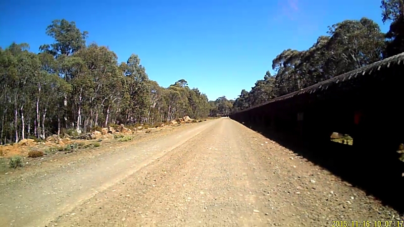
Stage 20 - Monday 16/11/15 - Derwent Bridge to Ouse (74.9kms)
After 19 stages of riding I reached the conclusion that there was no such thing as an easy day's ride on this adventure. This day was no exception.
Before I reached the Fourteen Mile Track early turn-off I met three people coming towards me, on my side of the road - two fit-looking men running and a slightly built fit woman on a bike (but no bike gear). I said "Hello" and asked "What's the story?" They told me they were running around Tasmania to support a charity MMFM (Making Money for Mary, I think). One of them also said it was in memory of his grandmother, who had passed away recently. I gave him a donation and chatted for a few minutes, wished them luck and continued on my way. They were being supported by a vehicle down the road, but I did not see one as I turned off the Lyell Highway before reaching the Fourteen Mile Track.
I was looking forward to hurtling down the hill to Wayatinah at warp speed but before that time came there were several significant hill climbs to overcome, as well as the gravel road that bypasses Tarraleah, Fourteen Mile Track.
Matthew had told me about a side road that would eventually lead to the road to Laughing Jack Lagoon. This apparently was a good quality, almost level road, quiet and peaceful with very little traffic, which would link to the Laughing Jack Lagoon Road then Fourteen Mile Track. Matthew was right. It was a pleasure to ride along this side road, then alongside the pipeline between Laughing Jack Lagoon and Bronte Lagoon.
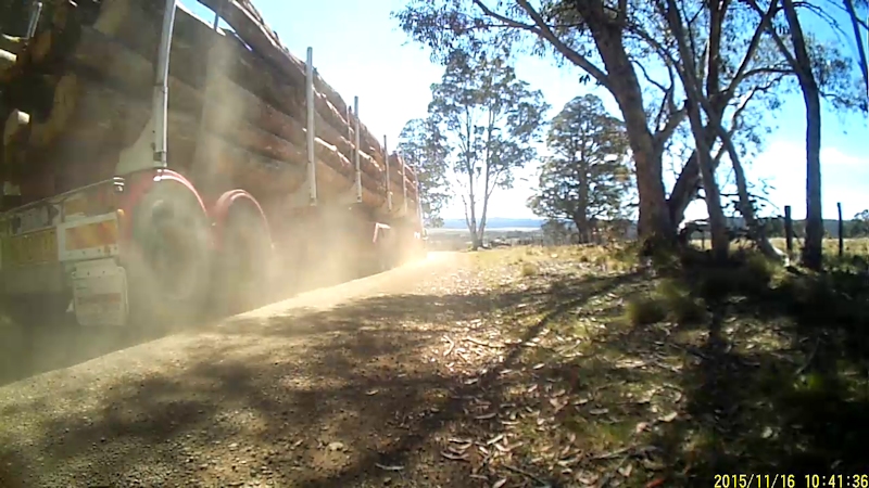
Once on Fourteen Mile Track I encountered one fully-laden log truck and two container trucks, all heading towards me. In all three instances I made sure I was well off the road to the left hand side as they thundered through, taking up the entire road as they went. I also saw two black (presumably tiger) snakes around 2kms apart, on the opposite side of the road. They appeared to be about 1.5m long, with a maximum diameter of about a vacuum cleaner hose. I did not bother them.
As was usual for me, I took extra care on the downhill runs to bridges, that invariably led to climbs away from creeks or rivers. I found Matthew waiting for me with a banana roll when I arrived at the Tarraleah Canal picnic area. Thank you Matthew.
From that point the road had some very steep parts, two of which I needed to push the bike up while walking. I did enjoy the buzz of screaming down the hill to Wayatinah but it was over all too soon. In contrast, the run down to Ouse was mostly in the highest gear range and I was often able to use my momentum from a fast run down a hill to carry me over some of the humps on the way. We had previously talked about possible places to stay in Ouse. Matthew thought the pub was closed and I had therefore expected that we would be staying at the oval in our tents, which is the suggested camp site for Tasmanian Trail travellers. However, the pub - the Lachlan Hotel - was still open and hence we stayed there for the night, courtesy of Matthew (again!). We enjoyed dinner at the pub while watching the cricket. I had crumbed flathead with chips and salad, probably the best fish meal I have ever had. For Matthew it was patties with chips and onion gravy. He said the test would be how they compared with those I make at home. Apparently, they were pretty good too.
Stage 21 - Tuesday 17/11/15 - Ouse to New Norfolk (54.3kms)
This day's temperature was forecast to be 26oC in New Norfolk so I wanted to make an early start - hence the 7.59am departure from Ouse. On Monday I noted that there was no such thing as an easy day's ride on this adventure. On this leg of the trip I was nearly proved wrong. Apart from the hill out of Hamilton (long but not very steep) and the winding hill near Gretna (steep enough for me to have to walk up part of it) I had a very good day on the bike.
Matthew was once again a great help on this stage of the journey, with a Nutella sandwich for me at the top of the Hamilton hill and chips, iced choc drink and a Kit-Kat near New Norfolk.
There were quite a few opportunities for fast downhill runs and I arrived at the New Norfolk Caravan Park at about 12.30pm for what I thought might be my last night away from home for a while.
Matthew helped unload the bike at the cabin and for a while I just sat in a chair with gear spread out all around me, thinking how close I was to home. Matthew left soon after and headed to his home to retrieve his cat, Basil, from his holiday home and, I hope, to have his injured knee properly examined and treated at the doctors.
Dinner was very plain - a Cup-a-Soup with sandwiches - followed by cheese and biscuits during the evening. I used the remaining bread, cheese and vegemite to make some sandwiches to eat en route to Lauderdale on Wednesday.
Stage 22 - Wednesday 18/11/15 - New Norfolk to Lauderdale (54.9kms)
The ride home was probably as good as it gets! At the start, 8.04am, the sky was slightly overcast, warm, with a light NW breeze - perfect for my final day on the road home.
The Lyell Highway to Granton provided a good run, with a wide shoulder on many sections of the road. Where these didn't exist, drivers gave me room. It was a bit disappointing for me that the coffee van was absent from the picnic area at Granton but, since I had food and drinks, not too much of a problem.
I turned off the highway and took the old, quieter Main Road through Granton and Austins Ferry. At Claremont I stopped at Subway for a flat white coffee but I could only manage half the cup before throwing the rest away in an outside drain. Not a good brew.
I continued along Main Road before rejoining the highway for a short distance and turned off at the Derwent Entertainment Centre to pick up the road to the Bowen Bridge via the Dowsings Point Army Barracks. Matthew was waiting for me near the pyramids at East Risdon with my dog, Topsy and a chocolate milk drink. I don't think Topsy knew what to make of me in my, probably, smelly bike gear and beard.
Matthew had persuaded me to use Gordons Hill Road and Cambridge Road to get me to Clarence Street in Bellerive. It was, in all likelihood, the best route but meant a steep climb up the narrow, winding Gordons Hill Road. I eventually arrived back home at 12.30pm, to a great welcome from Matthew and some neighbours.
It was a great relief to be back home after a wonderful adventure, to enjoy some quiet time - not on the bike. In a perverse way, I felt strangely a bit sad that it was all over.
Thanks to my son, Matthew, for being such a wonderful supporter and for helping me out in what would have been a very difficult situation for me far away from civilisation.